

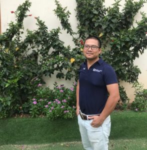
Hung Ha Quang
By Indiana State University
Jun 27, 2019
Hung Ha Quang’s, GR’17, reasons for being drawn to Indiana State University’s master’s degree in geography in 2015 were two-fold.
 The program’s use of satellite data for environmental and earth studies appealed to his career goals and his interest in research being conducted by department of earth and environmental systems faculty, especially Stephen Aldrich’s work with geographic information system and remote sensing and Jeffrey Stone’s research on lakes and water sciences modeling and monitoring.
His time at State yielded more than enough opportunities that he decided to continue his studies on campus, where he is now in the third year of the PhD program in spatial and earth sciences.
“State provided me with opportunities to involve in teaching undergraduate classes, where I can further strengthen my communicating skills,” Ha Quang said. “The training program in earth and environmental systems equipped me with knowledge and skills in programming and data sciences used for earth and environmental sciences. It is valuable for me in making myself becoming more competitive in the labor market towards the 4.0 industrial revolution.”
With international organizations like the World Bank, Food and Agricultural Organization and United Nations focusing their work in the use of spatial data, database and information system in urban planning and emergency response, Ha Quang knew he wanted to pursue an advanced degree.
“In my own view, after few years working for the World Bank in projects in Vietnam, I am aware of the use of geospatial data for land use/land cover mapping and urban planning in response to natural hazards such as urban flooding and climate change,” he said. “I had two master degrees in applied earth sciences from ITC (the Netherlands) in 2010 and in geography from ISU in 2017. But, to be able to lead research or collaboration projects in the use of geospatial technologies in urban studies, a more advanced study is nearly a ‘must’ for me.”
As a Sycamore, Ha Quang has delved into research in urban flooding, which is focused on mapping and monitoring patterns and trends of flood events in urban areas where there are densely populated communities.
“Remote sensing can provide a cost-effective way to continuously monitor flood events despite the sparse ground stations,” he said. “In my study, data acquired from various sensors will be used for monitoring data in different time periods and with various levels of details and types of information. Big data, or study using enormous amount of data, combined with time series analysis will help to characterize patterns of flood events in time and to predict future trends of flooding.”
Flooding is one of the most severe natural hazards in the world and Ha Quang hope to expand his understanding in big data analysis for urban planning and disaster risk management, specifically flooding.
“Given that, I will be able to better do the consulting works for international organizations, NGOs and research institutes in the world,” he said.
Ha Quang has watched his career goals flourish through mentors like Aldrich and Stone.
“Dr. Aldrich equipped me with valuable knowledge about earth and environmental systems as well as sharp programming skills for data processing. Later, Dr. Stone introduced me to different topics and research ideas in water resource monitoring,” he said. “These two faculties are among the very supportive faculties that we have here at earth and environmental systems. They are willing to advise and guide me both in my research plan and my personal life. If it was not for them, I could never achieve the knowledge, skills, and confidences that I have got today.”